Tokyo is pretty famous for its cafe culture in a WIDE array of niches from maids to robots to anime to a wide range of animals. Being pretty nerdy and about to embark on a long bird watching tour at the time, our natural fit was an owl cafe in the heart of Akihabara.
We booked months in advance as spaces fill up quickly (even months in advance there were hardly any spots left) and were very pleased with our experience. The place was run by a married couple that clearly loved their 40+ birds. Entries were timed, everyone was quiet and respectful, and they had a system for rotating through the various owls to stop them from getting overstimulated.
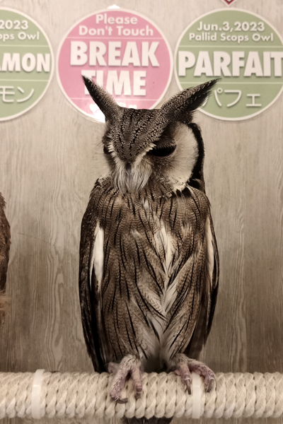
From the owl "menu" I couldn't pass on "Mr President" the Malay Eagle Owl and his magnificent eyebrows. For the larger birds the owners not only provide a glove to keep the talons out of your hand, but a nice rest to lean on so you can admire the bird without worrying about spooking it. The two of us hung out agreeably for most of our visit but I was still somewhat startled when our time was up and he flapped back to his perch in the corner.

Kathryn was more interested in mixing things up, so after a bit of time with Gorilla, a spectacled owl (we have an affinity for these birds, having seen them in both Costa Rica and Belize) she swapped out for Potsticker, a tropical screech owl, who was undoubtedly a lighter bird to carry.